Back on tour with destination Bull River Guard Station via Hwy 2 to Bullriver Rd Hwy 56. The previous day reverie subsumed, replaced by task oriented tension and the angst of miscalculation. Underestimating distance to Libby, a growing realization of fuel shortage. 58 miles from Libby, “Escape” warning of “50 MILES TO E”, then “25 MILES TO E”. 2 moose stand on the highway. Slowing, slowing, stopping, fumbling for camera, moose stride across the tarmac and into the photo sheltered woods off a side road. !!! Then, “10 MILES TO E”. Every downhill the car is in neutral. At “10” “Escape” helpfully counts down. At “0 MILES TO E” “Escape” coasts into a fuel station.

Eschewing the swinging bridge accepting teasing views of the Kootenai Falls to turn SW down the Bullriver canyon surrounded by the Montana Alps of the Cabinet Mountains.
Outside the familiar cabin a paint bucket partially water filled contains floating carcasses, a half dozen Mus sp. Inside the cabin has been rearranged and the back door cannot be unlocked by intact skeleton key hanging on a nail. The un intact key appears to have been broken off in the keyhole. This requires careful surgical extraction using a medical clamp brought along for this and other types of tool work.
A stop and sit on the banks of the East Fork of the Bull River, imagining big fish swimming in the rush,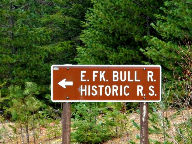 remembering a black and white picture taken over 100 years ago of the ranger Granville “Granny”Gordon standing on the station porch hefting a huge trout. Over the bend of the river, an eagle eyes the river with patience. An awe begins to return.
Pre hike pack check at Bull Lake, sitting in the shaded quiet faint little rings of feeding fingerlings randomly form on the otherwise still surface. Hydration,a fig cookie, and onto NFS 398 for a 6 mile round trip trek to Ross Creek Cedars.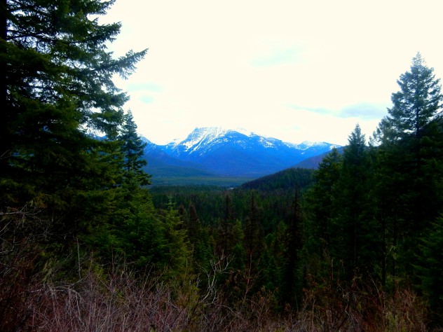
The tarmac road remains clear of snow in the first mile, but then with increasing altitude is snow covered and Yaktrax augment me merrells.
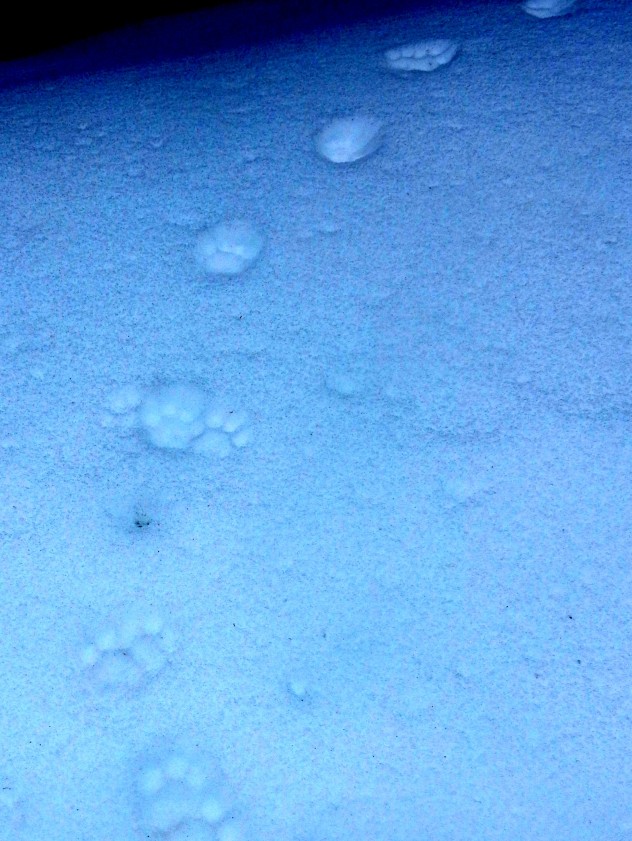
The Cabinets watch through the conifers and, at times from far below, and out of sight, Ross Creek sssssshhhhhhhhhhhsssssss es. Towering on the opposite canyon wall, the foothills of Sawtooth Mountain with areas of exposed rocky cliffs. Past the 2 mile mark, the winter trail begins to descend and the creek sound is closer. Fecal evidence of moose and, abundantly deer, animal tracks are scattered in the snow. But one track, that does not appear fresh, cuts in three places between the creek and the high rising forest. They are big, and round, and are easily three times larger then the very fresh dog prints. Do the Cougar Tracks dance!
Mar. 10th
During the night there begins a downpour soaking into dreams of an empty paint bucket being refilled with roof runoff. Any chance of further outdoor experience in this area is forfeited to this element. It is time to take “Escape” and go via Sandpoint and through the brumous sad stretch of Hwy 95 to the safety of a place that is home.